
The top 10 best hikes in the Eastern Townships
The Eastern Townships are one of our favorite places to explore in Quebec, especially when it comes to hiking trails and epic road trips. There’s so much to do here, considering how gorgeous the landscape is. Nestled in the mountains, with deep and beautiful valleys, and plenty of lakes sprinkled around, this is a hiker’s paradise. Which is why we wanted to share our top hikes in the Eastern Townships.
We’ll break down where each of these hiking trails is located in the Eastern Townships, how to get to them, and what to expect when you’re there. Hopefully, this will help you plan your trip accordingly and allow you to really enjoy everything this beautiful region has to offer.
If you’d like to plan a full stay in the Eastern Townships, check out our full travel guide here.
This article may contain affiliate/compensated links. For more information, please see our disclaimer here. We take all the efforts necessary to ensure the information included in this post is accurate, correct and current, sometimes, things just change! Travel information like opening hours, business operations and prices may change. If you find anything in this post that is incorrect or outdated, please let me know in the comments so I can update it for other readers. Cheers!

Table of Contents
The best hiking trails in the Eastern Townships of Quebec
We absolutely love to hike! In fact, with every opportunity we have, we head out and explore the trails near us. At home or during our travels, hiking is the best way to connect to nature and to discover hidden gems, breathtaking landscapes and meet new people.
Since we spend so much time in the Eastern Townships, we wanted to share some of the best hikes we’ve done here with you. There are plenty more trails, so slowly but surely, we’ll be updating this list to make sure you always have new trails to explore.
Looking for hiking trails near Montreal? We have all the best ones that are less than 2 hours away from the city in our full guide here.
3 must-do hikes in Coaticook
Coaticook is known for its amazing ice cream, beautiful scenery and the gorge that runs through the town. Luckily, the landscape here has made it so that there are plenty of hikes to do. Here are just three that we absolutely love!
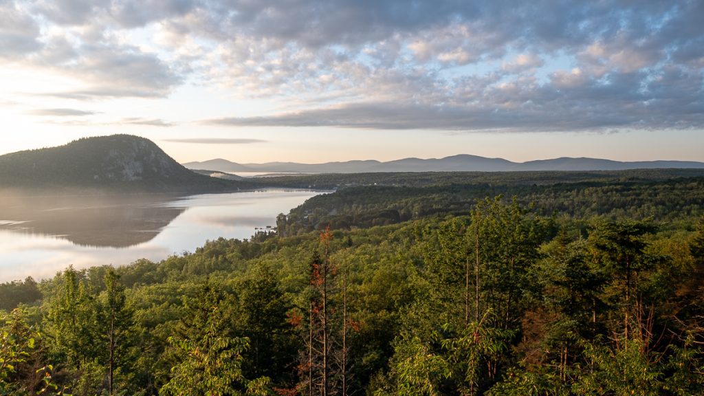
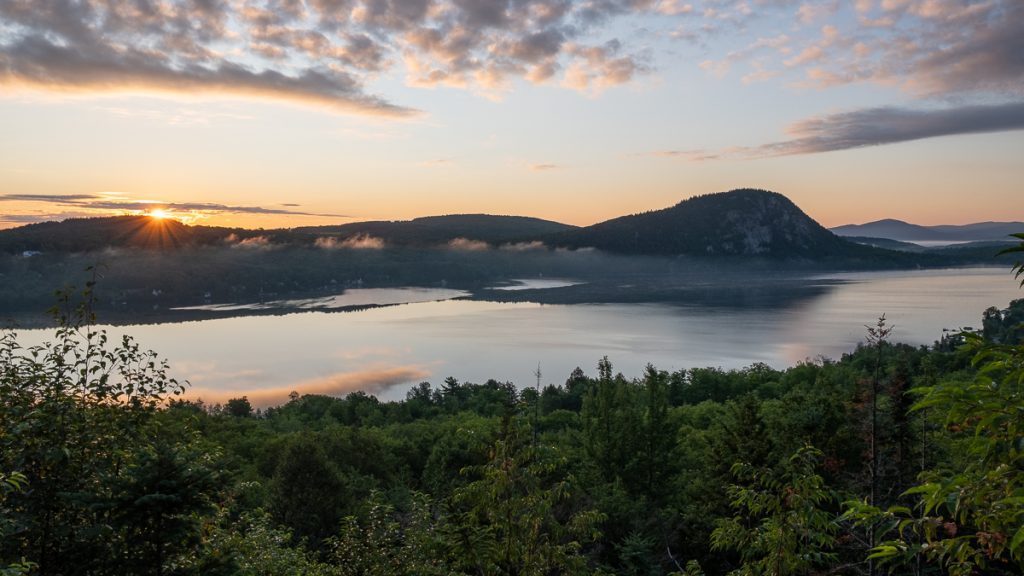
1. Catch the sunset on Mont Pinacle, one of the best hikes in Estrie
There is nothing we love more than an easy hike that gets you an amazing view. Low pain, huge gain! This is what Mont Pinacle is all about!
This trail is located in the Parc Harold F. Baldwin. Recently, many changes have been made to the trail and how it’s run. What used to be a free trail will now cost you $7 per person. But the money goes to preserve the park and the trails, so that’s ok!
To gain access to the main trails, you have to park your car in the church parking lot, a few hundred meters away. It’s clearly marked as the parking for Mont Pinacle. Parking is free and bathrooms are available on the side of the building.
Mont Pinacle is one of the best hikes in the area for an epic view of the sunset. You have different trail options, depending on your level of skill and physical condition. There are seven different routes to take, all are around 7km long. They range from easy to difficult, one of them being that you can climb up the cliff of the mountain. Overall, the hike will take you 1.5 to 2 hours roundtrip… Just make sure you leave enough time to enjoy the view at the top.
If you are heading there for sunset, make sure you have a light with you to see on your way down. There are no lights on the path. There are also no garbage bins on the mountain, only at the foot, so make sure you bring your trash down with you.
Also, note that this trail is closed from the end of November to mid-May. Although even locals hike the trail in the winter, we highly recommend you avoid it. It will help preserve the trail and the creatures living on it.
- Difficulty: Easy, but some stamina is required, especially for the route #2
- Length of hike: 7km. About 1.5 hours round-trip
- How to get there: Mont Pinacle is located in Coaticook. The actual address is 1891 Chemin May, Coaticook, QC J1A 2S4.
- Distance from Montreal: Mount Pinacle hike is about 170km away from Montreal. It’s about a 1 hour 50 minutes drive from downtown Montreal.
- Official website: https://parchfbaldwin.com/home
- Cost to access the hike: $7 for anyone over the age of 16
- Amenities: Bathroom in the parking lot. Benches on the trail. Garbage bins only at the entrance of the hike.
2. Catch sunrise on Mont Séguin, at Camping du Lac Lyster
Ok, this one is a secret hike that is only accessible to those who stay at Camping du Lac Lyster. Mont Séguin is a small hill located in the campgrounds.
Mont Séguin is a great place to catch sunrise, which is why staying at the campsite is great! You don’t need to wake up extra early or drive super far to get to it.
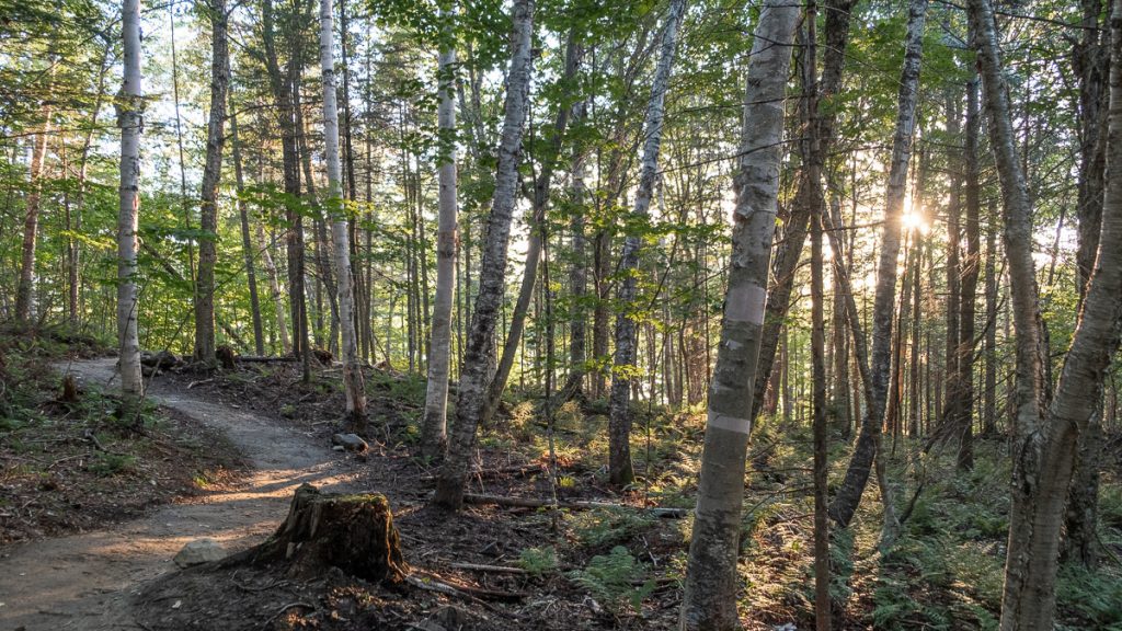
In fact, the hike up to the viewpoint is about 20 minutes long. From the campgrounds, there is a small sign indicating the start. From there, the path is super clear and you just keep going until you get to a rock platform. There’s also a picnic table there, if you want to enjoy a coffee or breakfast as a reward for getting up so early.
Plus, Camping du Lac Lyster is a great place to set up camp if you want to explore the Eastern Townships. They’re a few minutes away from Mont Pinacle, a beach and some of the best attractions in the area.
- Difficulty: Easy (and short)
- Length of hike: About 30-40 minutes round-trip
- How to get there: Mont Séguin is located in Coaticook. Access is through the Camping du Lac Lyster, at 360 Chem. des Chalets, Coaticook, QC J1A 2S4.
- Distance from Montreal: Mount Séguin hike is about 170km away from Montreal. It’s about a 2-hour drive from downtown Montreal.
- Official website: http://campingdulaclyster.com/
- Cost to access the hike: Free for those staying on the campground
- Amenities: The campground has set-up tents, rustic campgrounds, and communal bathrooms. There is nothing on the hike but a picnic table at the end.
3. Hike the beautiful Gorge de Coaticook, a riverside hiking trail in the Eastern Townships
Also located in the town of Coaticook, the Parc de la Gorge de Coaticook is one of the most special hikes in the area, not only because it’s on the river, but for so many other reasons.
First, it’s home to Foresta Lumina, an immersive experience in the park where the trees and surroundings get lit up. The Park is also home to the longest suspended footbridge in North America, a 169-meter beauty!
And let’s not forget that the hike is absolutely beautiful as well. There’s even a beautiful waterfall to admire. Seriously, this park and its hikes have something for everyone.
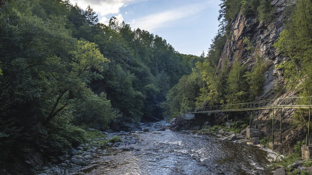
There are a few different hiking trails in the Gorge de Coaticook Park, ranging from 2.6 kilometers to 8.5 in total. These hikes take you on the suspended bridge, through caves, on platforms that go on the cliffside along the water. We took our time and explored all the nooks and cranies of the main trail and it might have taken us about 2 hours overall. It’s a very leisurely walk
Along the way, you’ll learn all about the history of the area and the different purposes the land severed, and the real evolution of the area. Best of all, there is a little ice cream shop at the end of the hike, so you can grab a little treat when you’re done. They serve the local Coaticook ice cream that is made in town, and have a few vegan options of a local sorbet as well!
- Difficulty: Easy
- Length of hike: Many trails – 2.6 kilometers to 8.5 in total. Times depend on length of hike
- How to get there: The Gorge Park is located in Coaticook. There are signs all around the area that point you to it.
- Distance from Montreal: The Coaticook Gorge Park hike is about 170km away from Montreal. It’s about a 1 hour 50 minutes drive from downtown Montreal.
- Official website: gorgedecoaticook.qc.ca/
- Cost to access the hike: The entrance to the hike is $8 for adults. You can also rent bikes and other equipment here. Check out their rates here.
- Amenities: Bathrooms, souvenir shop, ice cream shop, guides along the trail. There is also an observation tower on the trail
2 hiking trails in the Eastern Townships Parc d’environment naturel de Sutton
In the heart of the Eastern Townships, you have the Parc d’environement Sutton. With a focus on conservation, this nature park has many different trails to choose from with varying difficulty.
The Parc d’Environnement Naturel de Sutton (PENS) is dedicated to preserving the local ecosystem, with over 52 kilometers of trails that offer a mix of forest, wetlands, streams, and rocky ridges.
We got to enjoy 2 different trails during our visit to this park. Rest assured that there are many others to enjoy as well, depending on what you’re looking for.
Although we didn’t hike these trails, Dos d’Orignal and Mont Gagnon offer amazing views of the surrounding valleys, forests and mountains, if you’re chasing epic views.
The park is open year-round, so you can enjoy the trails here during all the seasons. However, the hiking trails are closed during the snow melt. This is usually from mid-April to mid-May, depending on the weather.
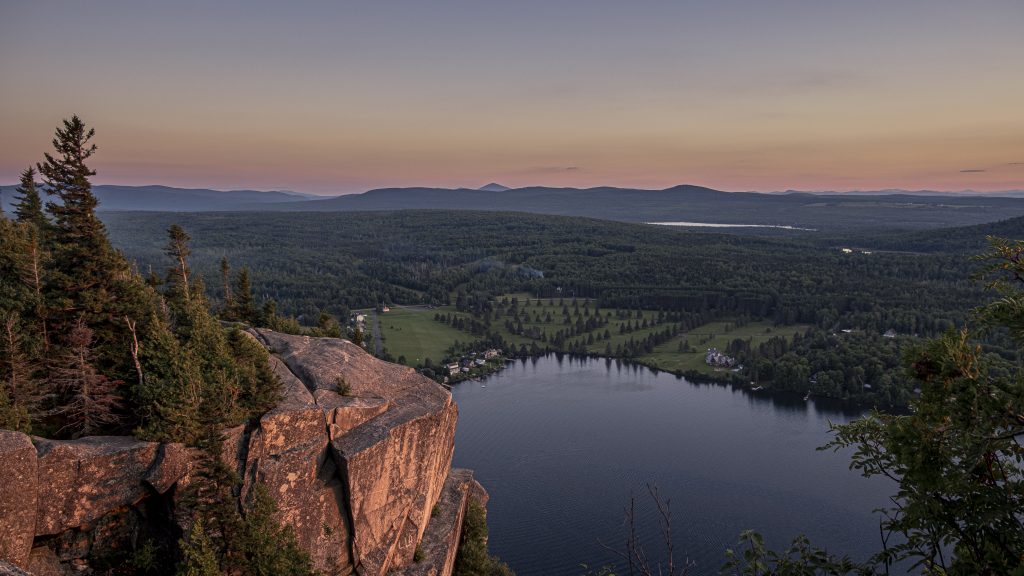
4. Check out the Round Top Trail in the Parc d’environement naturel de Sutton
The first trail we explored during our time at PENS as the Round Top Trail. It’s one of the most famous hikes in this park. On this trail, you’ll climb up to a 968-meter-high summit where you can enjoy panoramic views of the surrounding mountains and the Vermont border.
We enjoyed this hike in the early fall and it was really enjoyable. Although the leaves hadn’t turned yet, there was plenty to enjoy.

This hike will require some good physical condition since it’s about 3 hours long and spans a distance of 7.4 kilometers. Elevation gains are of 540 meters.
We visited after a rainy day, so the trails were quite muddy. It added an extra challenge to the hike, but nothing too crazy.
You should note that the only viewpoints are at the top. There is good cover during the majority of the trail.
- Difficulty: Moderate to difficult
- Length of hike: 7.4 kilometers
- How to get there: The trail starts near the ticket office of the Parc d’environment naturel de Sutton
- Distance from Montreal: The PENS is located about 115 km from Downtown Montreal. The drive there will take about 1 hour to 20 minutes
- Official website: parcsutton.com/en/
- Cost to access the hike: The entrance to the hike is $8 for adults.
- Amenities: Bathrooms and welcome booth at the entrance. No other amenities on the trail. Welcome booth is located at 800, Chemin Réal (altitude 520).
5. Check out the waterfall at the PENS
Since there is a paying entrance, we decided to make the best of our time at the PENS and did another short hike.
The Sentier des Chutes du Pekan is a short stroll through a lush forest that will take you to a waterfall.
To be very honest, the waterfall was less than impressive. Not quite like the other beautiful waterfalls we’ve seen in Quebec.
If you’re looking for a short hike, especially if you have kids or people who are not in great shape, this is a nice option.
- Difficulty: Easy to moderate
- Length of hike: This is a loop trail that spans over 10km but you can turn back anytime.
- How to get there: The trail starts near the ticket office of the Parc d’environment naturel de Sutton
- Distance from Montreal: The PENS is located about 115 km from Downtown Montreal. The drive there will take about 1 hour to 20 minutes
- Official website: parcsutton.com/en/
- Cost to access the hike: The entrance to the hike is $8 for adults.
- Amenities: Bathrooms and welcome booth at the entrance. No other amenities on the trail. Welcome booth is located at 800, Chemin Réal (altitude 520).
6. Check out the trails at the Abbaye Saint-Benoit du Lac
One of our favorite places to visit in the Eastern Townships is the Abbaye Saint Benoit du Lac.
It’s a beautiful landmark of the region, and it’s also a great place to go hiking. The great thing is that you can actually choose how far you hike.
The Abbaye is the starting point of the Circuit de l’Abbaye. This is a long-distance 149 km long hiking trail that forms a loop.
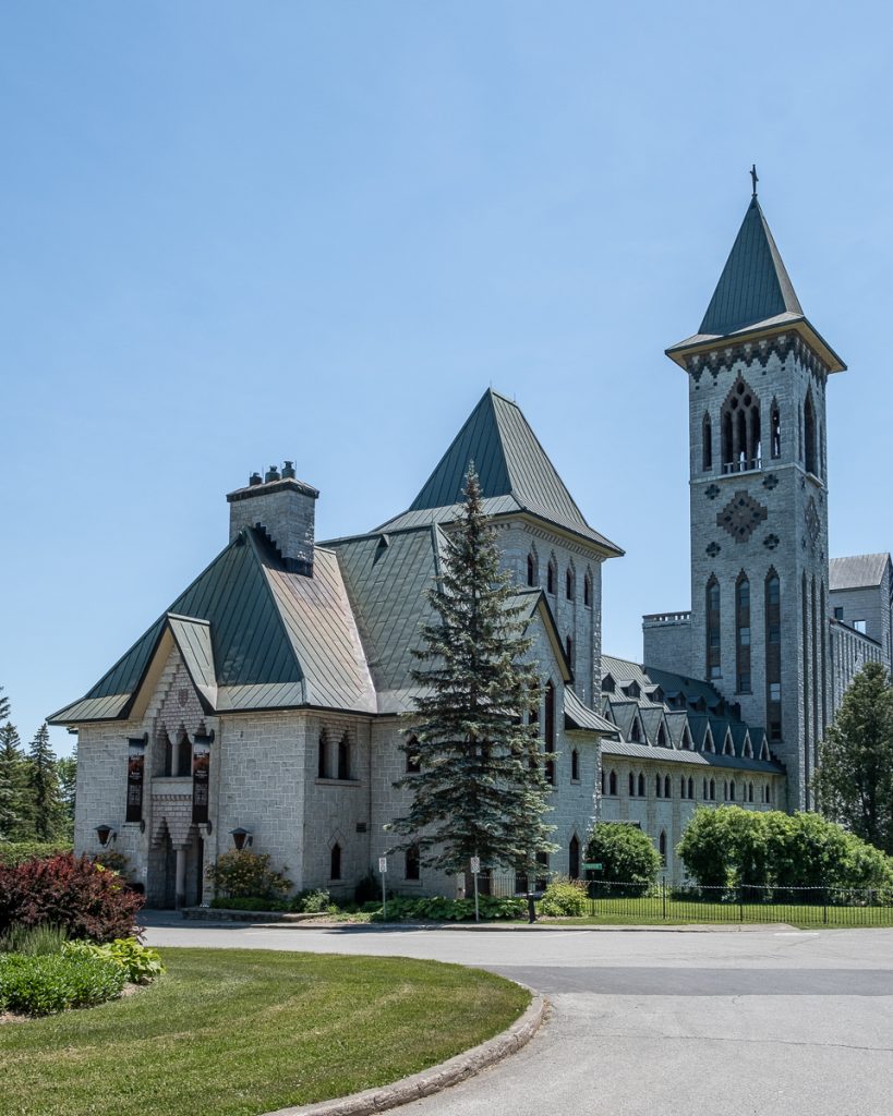
The trail takes you through mountains and valleys, and crosses seven different municipalities. It can take anywhere from eight to ten days to hike.
But for those who are looking for a shorter trail, we recommend exploring the Abbaye’s grounds. Here, you can find close to 2 km of footpaths called the Prayer Paths.
They have been developed with the intention of contemplation and prayer. This is also because the Abbaye hosts retreats (some silent ones), where guests can recharge.
- Difficulty: Easy
- Length of hike: About 2 km
- How to get there: The trail starts at the Abbaye Saint-Benoit-du-Lac
- Distance from Montreal: The PENS is located about 129 km from Downtown Montreal. The drive there will take about 1 hour to 25 minutes
- Official website: abbaye.ca/en/
- Cost to access the hike: The entrance to the hike is free of charge
- Amenities: Bathrooms are available at the Abbaye. There is also a gift shop where they sell treats and snacks.
3 amazing hiking trails in the Mont-Orford national park & Orford town
Orford is a great town in the Eastern Townships. It’s a wonderful place to see up camp, especially if you’re planning on exploring around. It’s central, it’s big and it has everything you need in terms of accommodations, stores, activities, and more.
So here are 3 amazing hiking trails in Orford. Two are in the national park, while one is very close to it, about a 5-minute drive away.
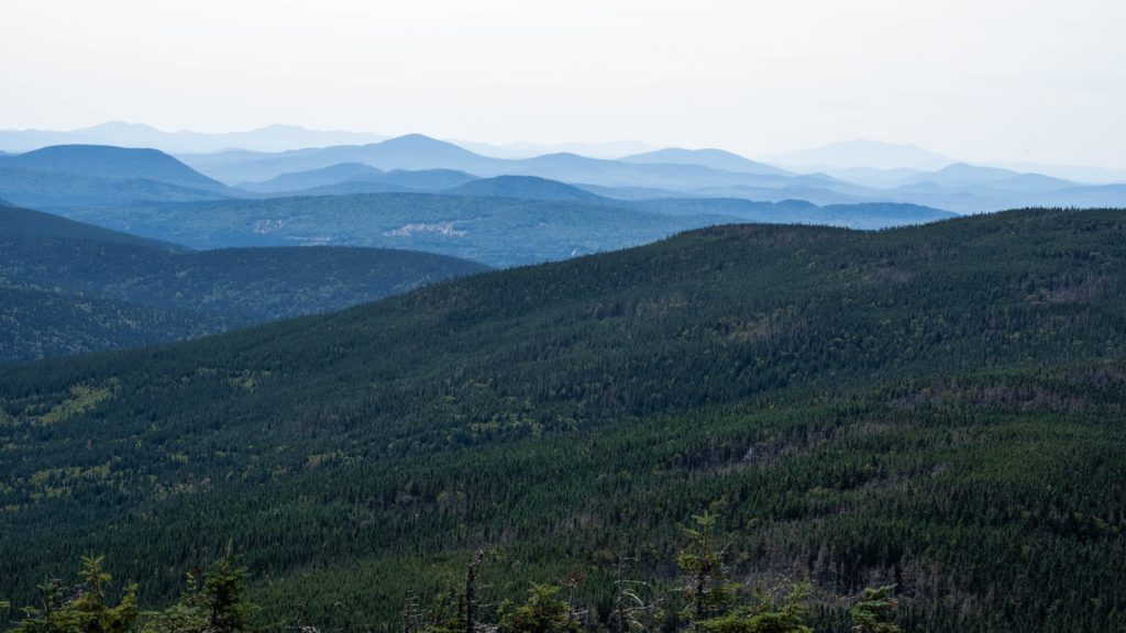
7. Get a view of the Eastern Townships by hiking up Mont Chauve
Mont-Chauve is a one of the highest peaks to climb in the Mont-Orford national park. It’s great because it gives you an amazing vantage point of the whole area. We hiked this trail in the Eastern Townships in the fall, and the views did not disappoint!
This trail is a 10.6 km intermediate hike that goes up about 600 m in altitude. It leads to the barren rocky summit of Mont Chauve. Fun fact – Mont Chauve actually means Mount Bald! Quite a fitting name!
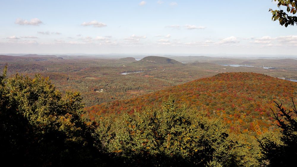
The Mont Chauve hike is located at the Lac-Stukely Sector of the Mont-Orford national park. There are quite a few viewpoints during the hike, but the main one is the most impressive (and most crowded). It’s worth bringing snacks or lunch on this 4-hour round-trip hike. Once you get to the summit, grab a seat, enjoy the view and your meal. It’s really an impressive one!
Like most trails in the national parks, the hike is very well marked and well-maintained. It’s impossible to get lost. Just know that it does get steep in certain areas. It’s not a difficult hike by any means, but its length will require some endurance.
- Difficulty: Easy to intermediate. Because it’s a long and sometimes steep hike, stamina is needed
- Length of hike: 10.6 km, about 4 hours round-trip
- How to get there: The Mont-Orford national park is located in the Eastern Townships region. The best way to get there from Montreal is to take Highway 10 E, in the direction of the Eastern Townships, and get off exit 118. At the stop sign at the end of the exit ramp, turn left on Route 141 Nord. Drive about 5 km, passing the Mont-Orford golf course and Orford Musique. After the curve, follow directions for “Secteur du Lac-Stukely, 300 meters”, turn right, and follow the indication “Centre de services”.
- Distance from Montreal: The hiking trails at Mont-Orford national park are about 125km away from Montreal. It’s about a 1 hour 20 minutes drive from downtown Montreal.
- Official website: sepaq.com/pq/mor
- Cost to access the hike: $9.25 as this is a Sepaq national park.
8. Stroll along on the L’Étang-Fer-de-Lance hiking trail in Orford
Unlike Mont Chauve, this hiking trail in Orford is actually quite easy. We consider it more of a stroll in the park with a nice view at the end. If you’re looking for a short hike that you can bring your dog on, this is the one for you.
The hike starts at the Bonnalie service center and takes you up along a path that is near the camping spots for the national park. You then head deeper into the forest, full of maples, where you can spot many birds, including woodpeckers. And if you don’t spot them, you’ll surely hear them!
At the end of the hike, you will come up on this viewing platform that gives you an amazing view of the lake there and a mountain behind it. With a few picnic tables and benches around, it’s a great place to take a seat and enjoy the view. You’ll be able to spot so many birds and animals from here. If you have binoculars, make sure you bring them along!
On your way back, you can either follow the same path you took or go a different route. The longer route will bring you to another viewpoint… that has no view. When we visited, it was obstructed by other trees.
If you have the time, the second longer route is a nice trail to take (not many people use this trail), but there’s nothing notable to see. If you’re tight on time, you can simply take the same route you took back to the service center.
- Difficulty: Easy (and short)
- Length of hike: 3.5 km, a little over an hour to hike
- How to get there: The Mont-Orford national park is located in the Eastern Townships region. The best way to get there from Montreal is to take Highway 10 E, in the direction of the Eastern Townships, and get off exit 118. At the stop sign at the end of the exit ramp, turn left on Route 141 Nord. Drive about 5 km, passing the Mont-Orford golf course and Orford Musique. After the curve, follow directions for “Secteur du Lac-Stukely”, turn right, and follow the indication “Centre de services”.
- Distance from Montreal: The hiking trails at Mont-Orford national park are about 125km away from Montreal. It’s about a 1 hour 20 minutes drive from downtown Montreal.
- Official website: sepaq.com/pq/mor
- Cost to access the hike: $9.25 as this is a Sepaq national park.
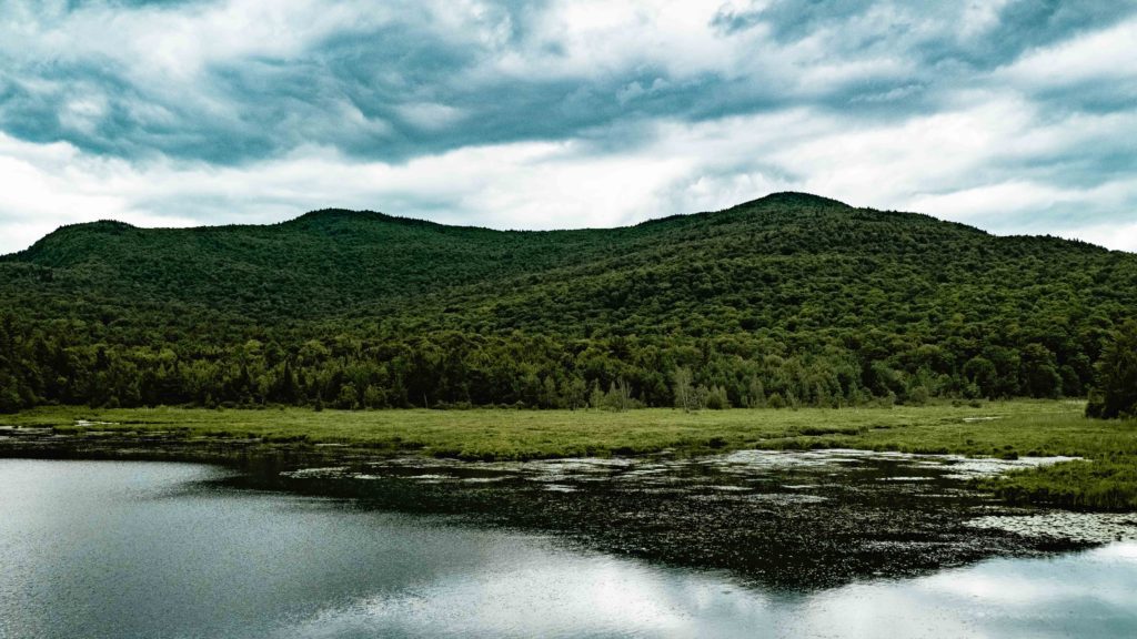
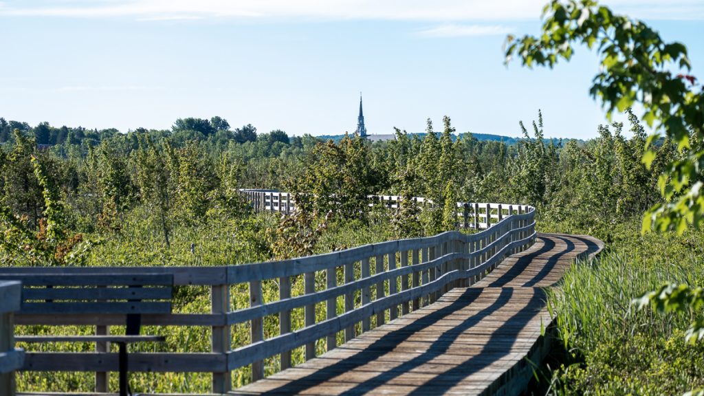
9. Walk on the boardwalk of the Marais de la Rivière-aux-Cerises park
Located a short drive from the Orford National Park, the Marais de la Rivière-aux-Cerises is a lovely park that’s the perfect mix of walking on a boardwalk and in the forest. This easy hike is perfect for those who want to go for a run, or leisurely explore the park. This path will take only about 1.5 hours round-trip, at a relaxed pace, and with many stops to admire the view
The boardwalk passes through the marshes where you can admire a view of the area, nestled in the mountains. You can also check out the fauna and flora – there are a ton of amazing plants, plus really cool birds, turtles and more. Plus, the walk is really lovely at sunrise or sunset.
In the summer, you can also explore the Marais de la Rivière-aux-Cerises by kayaking on the waterways. Also, there is a service center at the entrance, where you have a bunch of amenities. Plus, there is a parking lot, which is the only thing you have to pay for while you’re here (other than activities).
If you’re looking to get a different experience than what you have at the national parks, the Marais de la Rivière-aux-Cerises is a great place to discover.
- Difficulty: Easy
- Length of hike: 1.9 km of paths on stilts (boardwalk), 6 km of paths in the summer and 2.8 km of winter paths. Most trails are 0.6 km long.
- How to get there: The Marais de la Rivière-aux-Cerises is located at LAMRAC, 69 Chemin Roy, Magog, QC J1X 0N4
- Distance from Montreal: The Marais de la Rivière-aux-Cerises is 120km away from Montreal. It’s about a 1 hour 15 minutes drive from downtown Montreal.
- Official website: Maraisauxcerises.com
- Cost to access the hike: Free to hike. Parking is $2.50 per hour or $10 for the day
- Amenities: Bathrooms, interpretation center, parking. Possibility to rent watersports equipment.
A challenging hike near the US border, in the Eastern Townships
Our last hike in the Eastern Townships is one of the most challenging ones. It will require some time and planning, depending on your skill level, and how far you want to go on the hike. This is a beautiful mountain top to discover with many trails leading you there.
10. Mont Gosford, one of the hardest trails to hike
Mont Gosford is located on the US-Canada border and it stands tall at an altitude of 1,193 meters, making it the 7th highest peak in Quebec. Its territory covers 61 square km, and once you’re at the summit, you get a breathtaking 360 view of it all!
There are many different ways to get to the top of Mont Gosford. There are 40 km of trails that will take you on the ridges or bottoms of the valleys where you can discover the landscape, diverse forests or plentiful wildlife. At the top, not only do you get to see the mountains of Maine and New Hampshire, but also the region of Lac Mégantic.
The trails are open all year-round, except during moose hunting season. We would recommend getting up to Gosford as early as possible as the paths tend to get crowded on weekends. Luckily, you can decide to camp at the park where you can enjoy one of the best starry skies in the province.
The most popular hike is Path Number One leading from the reception to the top. It’s 20 km round-trip and should take about 7 hours. If you’re looking for a shorter hike, the one to and from Parking 1 will only take 3 hours and is about 8.5 km long. Other hikes vary between 4-6 hours.
If hiking up one of the trails of Mont Gosford is not a challenge for you, you can decide to continue on your path and hike the Route des Sommets which trails around the Megantic region for 157 km.
Overall, the views you’ll get on this hike are worth the challenge. Plus, the different paths make it that you can be gone for as long or short as you’d like.
- Difficulty: Intermediate to hard, depending on the route you take
- How to get there: The Mont Gosford park is located at 901 rang Tout-de-Joie, St-Augustin de Woburn, Québec, G0Y 1R0
- Distance from Montreal: Mont Gosford park is about 245 km away from Montreal. It’s close to a 3-hour drive from downtown Montreal.
- Official website: montgosford.com
- Cost to access the hike: The entrance to the hike is $5 for adults. Other rates apply depending on what you want to do. Check out their rates here.
- Amenities: Bathrooms on the trail, the observation tower at the summit, campsites, cabins for long-term hikers.
Looking for more things to do in the Eastern Townships? Check out some of our other articles here:
– Staying at Chalets Hygge in Orford
– All the best things to do in the Eastern Townships
– Glamping at Laö Cabines in Racine
– The best road trips in the Eastern Townships
The 10 best hikes in the Eastern Townships of Quebec
Here you have it! The 10 best hiking trails you can explore in the Eastern Townships. There is something for every skill level and distance you want to cover. And, these hikes are sprinkled all over the Townships, so no matter what town you’re visiting, you can find the right hike for you.
As a reminder, here they are again:
- Mont Pinacle
- Mont Séguin
- Gorge de Coaticook
- Round Top
- Chute du Pékan
- Abbaye Saint-Benoit-du-Lac’s trails
- Mont Chauve
- L’Étang-Fer-de-Lance
- Marais à la Rivière-aux-cerises
- Mont Gosford
Make sure you come back and check this article out again, as we’ll be updating the hikes here often.
Let us know in the comments what hikes you’re looking forward to doing. Is there anything else you want to know about these hikes? Are there any other trails we should be adding to our list?
Thank you so much for reading the article all the way through!
We put a lot of time and effort into the content we create. Please like, comment and share – every action on your part helps us out tremendously and is very appreciated.
You can also help us by pinning this article for others to find.
