The 8 best hikes in the Laurentians
Here are 8 amazing hikes in the Laurentians region of Quebec. Learn what you need to pack, what to expect and everything else you need to know about hitting the hiking trails in the Laurentians.
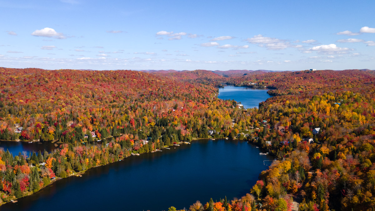
The Laurentians are one of the most beautiful and popular regions in Quebec. It’s no surprise since the landscape is breathtaking – with mountains and valleys all over the area – that it is the perfect destination for hiking in Quebec.
Plus, it’s home to one of the best ski hills in the province, the Mont-Tremblant resort. And, it’s where the oldest national park in Quebec is – the Mont-Tremblant national park. The whole region is accessible from Montreal, just an hour and a half away, making the Laurentians the perfect place to visit on a weekend trip or a day trip from Montreal. It’s also very close to Ottawa and the US border.
We absolutely love visiting the region, not only to explore the little towns sprinkled throughout the region but mainly to go camping and on hikes. With so many mountains around and a spectacular national park, with different areas to explore, it’s no wonder there are so many amazing hikes in the Laurentians.
Table of Contents
Where the Laurentians are located
The Laurentians are located northwest of Montreal. The region starts in Deux-Montagnes and stretches much further north, well past Mont-Laurier. Its most famous cities and towns are Saint-Jerome, Mont-Laurier, Saint-Sauveur and Mont-Tremblant. In fact, for those who love road trips, the scenic route makes it one of the best drives in Quebec.
Because it’s so close to Montreal, less than 30 minutes away on a good day, it has become a very popular weekend destination for outdoor enthusiasts. If you want to get to the heart of the Laurentians, between Saint-Sauveur and Mont-Tremblant, the 1-1.5h drive is not so bad either. That’s what makes it perfect for day trips and weekend getaways.
Since the region has over 16 parks and reserves, and over 9 000 lakes and rivers, there’s something for everyone to enjoy. Not only will you find the best of the outdoor activities here year-round, from hiking to skiing, to biking and swimming, but the Laurentians are also a great foodie destination as well as a history buff’s dream come true.
How to get to the Laurentians from Montreal
The best way to get to the Laurentians from Montreal is by car. In fact, road-tripping through the Laurentians is one of the most scenic Quebec drives you can go on. You can hop on Autoroute 15 North and head straight to the Laurentians from there.
Alternatively, you can also opt to take a bus from Montreal to the Laurentians, which is a more eco-friendly way to get there. There is also an airport in Mont-Tremblant, but we don’t recommend flying in. Not only is it bad for the environment, but you also miss out on driving scenic routes.
Because of its proximity to the border, the Laurentians are also a big tourist destination for New England residents, as well as Ontarians living near Ottawa.


6 amazing hikes in the Mont-Tremblant national park
If you’re looking for a spectacular national park to explore that is near Montreal, look no further than the Mont-Tremblant national park. This is the oldest SEPAQ national park in Quebec and home to a ton of amazing hikes, waterfalls, beaches and so much more.
We love camping at this park and spending summer days hiking its trails or lounging on its beaches – often doing a mix of both!
So here are the 6 best hikes in the Laurentians’ Mont-Tremblant national park.
1. La Roche hiking trail in the Laurentians
The La Roche hiking trail has to be one of our favorite hikes in the Laurentians and even in Quebec. It’s one of those low effort – high payoff ratio hikes. The whole hike will take about 2 hours round trip. Although the SEPAQ categorizes it as being an intermediate hike, we think it’s a little easier than that. Sure, there are elevations on the trail, but the shortness of it makes it closer to an easy hike.
The trail is very well-maintained, as all SEPAQ hikes are, so it’s quite easy to stay on the path and to go with children. It’s a family-friendly and dog-friendly hike as well.
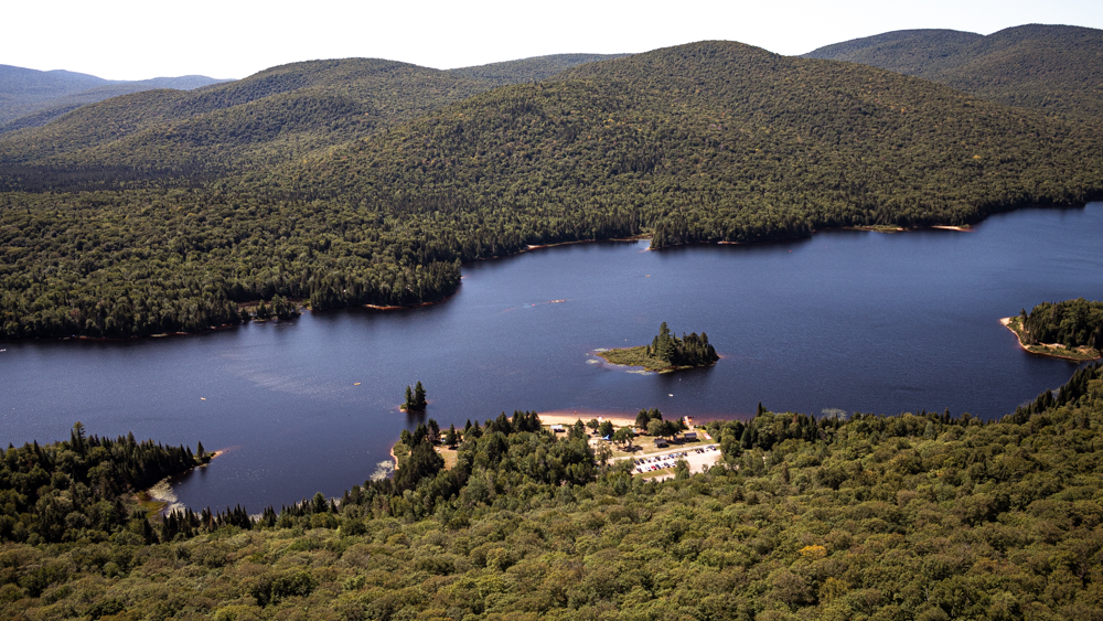
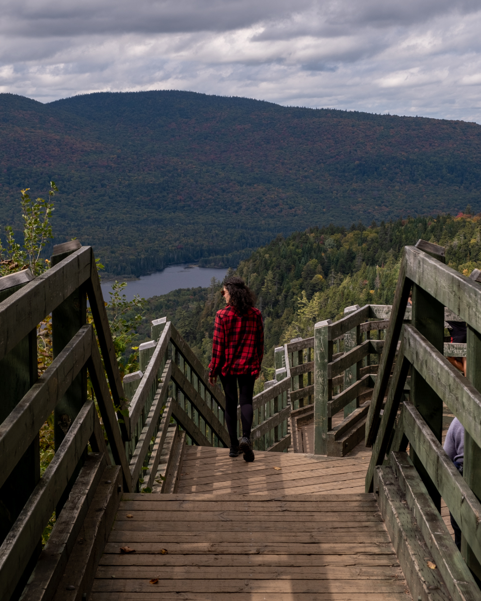
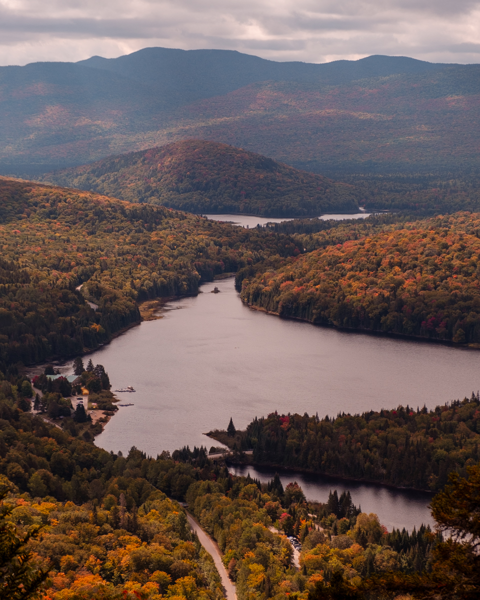
The trail ends on a large rock formation, hence why it’s called La Roche, meaning The Rock in French. Once at the top, you’ll get a panoramic view of the glacial valley at the heart of the mountains. You’ll see Lac Monroe, located in the Mont-Tremblant national park, as well as the Mont-Tremblant highlands. Lac Monroe is the perfect place to head after your hike – there, you can chill on the beach or kayak, paddleboard or swim.
if you’re looking for a short hike with a good payoff, La Roche is the one for you in the Mont-Tremblant national park. And if you want to extend the hike, you can take the La Coulée path to join the La Corniche trail.
- Difficulty: Intermediate because of the 250m elevation, but quite easy for people in good shape
- Length of hike: 5,4 km long round-trip, about 2 hours total
- How to get there: You have to go to the Secteur de la Diable in Mont-Tremblant national park, then head to the clearly marked La Roche, La Corniche parking lot.
- Distance from Montreal: About 2 hours to get to the parking lot. About 160 km from Montreal
- Official website: The SEPAQ website for the Mont-Tremblant national park
- Cost to access the hike: $9.25 for a day pass to the SEPAQ park
- Amenities: There are bathrooms at the foot of the trail. Nothing on the trail, so be sure to bring your trash back with you. Once in the park, you can take advantage of the other amenities at the discovery center.
2. Hike La Corniche in the Mont-Tremblant national park
La Corniche is another one of those low-effort high-payoff hikes we love! It’s located right next to the La Roche trail, but it’s slightly shorter. This one will take you about 1.5 hours round-trip. However, we feel like the view from the La Roche observation deck is slightly better. But that’s our personal opinion!
La Corniche is also a family and pet-friendly hike. Of course, your dog has to be on their leash to enjoy the hike. Since the elevation on this trail is not as high as La Roche, it is slightly easier than the previous, although the SEPAQ still categorizes it as an Intermediate one.
Once at the top, you get a similar view to La Roche, overlooking the Lac Monroe valley and the Mont-Tremblant highlands.
- Difficulty: The Sepaq also says this is an intermediate hike, but we think it’s pretty easy.
- Length of hike: 3,4 km roundtrip which will take about 1.5 hours. But we recommend enjoying the view from the top for a little bit!
- How to get there: You have to go to the Secteur de la Diable in Mont-Tremblant National Park, then head to the clearly marked La Roche, La Corniche parking lot.
- Distance from Montreal: About 2 hours to get to the parking lot. About 160 km from Montreal
- Official website: The SEPAQ website for the Mont-Tremblant national park
- Cost to access the hike: $9.25 for a day pass to the SEPAQ park
- Amenities: There are bathrooms at the foot of the trail. Nothing on the trail, so be sure to bring your trash back with you. Once in the park, you can take advantage of the other amenities at the discovery center.
3. Take the La Coulée trail between La Corniche & La Roche
La Coulée is a hiking trail that links the observation decks of the La Corniche and La Roche trails. Once on the La Roche or La Corniche trails, you will see signs to La Coulée, and then to the other trail.
This is also a pet and family-friendly trail with well-maintained paths. There aren’t any viewpoints on the trail, as this is really a connecting trail.
If you have the time, we recommend doing this triple hike that combines the La Roche, La Corniche and La Coulée trails. The whole loop will take about 3 hours which is the perfect way to spend a morning before heading to one of the beaches at the Mont-Tremblant national park.
- Difficulty: Intermediate (we feel the same about this trail – it’s fairly easy but there is a 255 m elevation)
- Length of hike: 8,2 km for the combination of La Roche, La Coulée and La Corniche trails. The loop should take about 2 h 45 to 3 hours.
- How to get there: You have to go to the Secteur de la Diable in Mont-Tremblant national park, then head to the clearly marked La Roche or La Corniche parking lot.
- Distance from Montreal: About 2 hours to get to the parking lot. About 160 km from Montreal
- Official website: The SEPAQ website for the Mont-Tremblant national park
- Cost to access the hike: $9.25 for a day pass to the SEPAQ park
- Amenities: There are bathrooms at the foot of the trail. Nothing on the trail, so be sure to bring your trash back with you. Once in the park, you can take advantage of the other amenities at the discovery center.
4. Check out this impressive waterfall on the Chutes du Diable hike
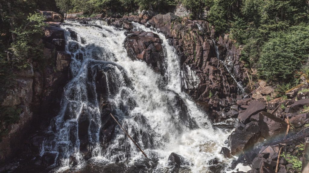
The Chute-du-Diable hike is a fun and short hike that takes you to a very impressive waterfall. You can hear the 15-meter waterfall roaring for most of the hike, with slight sneak peeks available on the trail.
A short 15-minute hike with a little 15m elevation will get you to the waterfall. There, you have a two-tiered observation deck where you can get a great view of the waterfall.
The hike is very family-friendly, but pets aren’t allowed on this trail. You will also find that some days, especially on weekends, the SEPAQ sets up information booths on the trail where you can talk to the local rangers and guides about different topics from plants to mushrooms and animals at the park.
- Difficulty: Easy
- Length of hike: A short 1,6 km hike that will take 30 minutes round trip
- How to get there: You have to go to the Secteur de la Diable in Mont-Tremblant national park, you will head to the Chute du Diable parking lot, 7 km north of the Discovery Centre
- Distance from Montreal: About 2 hours to get to the parking lot. About 160 km from Montreal
- Official website: The SEPAQ website for the Mont-Tremblant national park
- Cost to access the hike: $9.25 for a day pass to the SEPAQ park
- Amenities: There are bathrooms at the foot of the trail. Nothing on the trail, so be sure to bring your trash back with you. Once in the park, you can take advantage of the other amenities at the discovery center.
5. Stroll along the river to see the Chutes Croches cascade
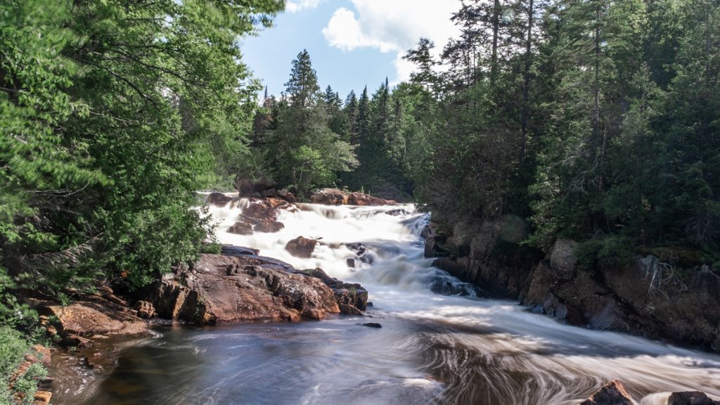
If you’re looking to go on an easy breezy hike, this is the one for you. There’s a longer bike path that goes along this route if you want to go explore for more time. Plus, you follow the river and see the cascades from many different viewpoints.
Depending on the day and the amount of rain that fell before your hike, the Chutes Croches, or crooked waterfalls, can look different. Either way, this little stroll is perfect for families. The trail goes on bridges, through the forest, and along the river. It’s easy and enjoyable.
The views aren’t epic, but the trail is quite nice and relaxing. This hike is the perfect place to grab a bite to eat while you hang out and listen to the water flow.
- Difficulty: Easy
- Length of hike: This is a short 720m hike that will take you 20 min round trip
- How to get there: You have to go to the Secteur de la Diable in Mont-Tremblant national park, then to the Chutes-Croches parking lot, about 5 km north of the Discovery Centre
- Distance from Montreal: About 2 hours to get to the parking lot. About 160 km from Montreal
- Official website: The SEPAQ website for the Mont-Tremblant national park
- Cost to access the hike: $9.25 for a day pass to the SEPAQ park
- Amenities: There are bathrooms at the foot of the trail. Nothing on the trail, so be sure to bring your trash back with you. Once in the park, you can take advantage of the other amenities at the discovery center.
6. Hike Le Centenaire the latest trail in the Mont-Tremblant national park
One of the most recent additions to the Mont-Tremblant national park trail roster was Le Centenaire, which means the centenary, or 100-year anniversary. This hiking trail in the Laurentians was created for Mont-Tremblant park’s 100th anniversary.
The trail starts in one of the rustic campgrounds of the park, La Sablonnière. When we hiked the trail, parts of it were closed, so we couldn’t do the full loop. Instead, we started from La Sablonnière and had to turn back around on our steps at the top.
The trail, which has a 430-meter elevation difference, starts with a long walk on a flat surface for a few kilometers. Don’t be fooled into thinking this is an easy hike. You’re only getting started. Soon, you’ll notice this Laurentian hiking trail starts to ascend. The climb is steep at times, and sometimes for extended periods of time. You can understand why it’s ranked as a difficult hike.
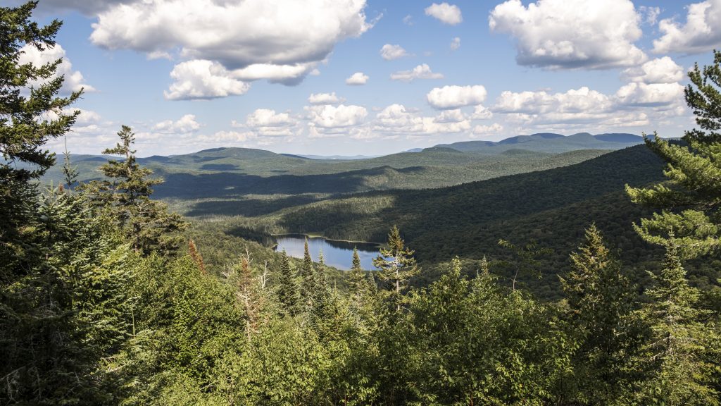
Luckily, there were quite a few unofficial viewpoints on the trail which make the challenge fun. There are plenty of openings in the trees where we could see the beautiful view, and some have flat surfaces so you can hang there for a while, out of other hikers’ way. The best views, however, were at the top of the climb. There, you will find some huge boulders you can claim to enjoy your lunch or snack. The view you get to admire along the trail is that of the Diable River and the Boulé forests
The trail is well-maintained, and not recommended for families or pets. It is not a dog-friendly hike. But, it is a mushroom-friendly hike, so look out for them along the trail. Just remember that you can claim mushrooms at the Mont-Tremblant park, as long as you stay on the trail (and know your mushrooms really well).
- Difficulty: Difficult
- Length of hike: The full trail loop is 11,6 km long, and will take between 3 to 4 hours to complete. With snacks and rests, and a little photoshoot, the hike took just about 4 hours to complete.
- How to get there: You have to go to the Secteur de la Diable in Mont-Tremblant national parkand find the La Sablonnière campground parking lot. It’s located 7 km south of the discovery center.
- Distance from Montreal: About 2 hours to get to the parking lot. About 160 km from Montreal
- Official website: The SEPAQ website for the Mont-Tremblant national park
- Cost to access the hike: $9.25 for a day pass to the SEPAQ park
- Amenities: There are bathrooms at the foot of the trail. Nothing on the trail, so be sure to bring your trash back with you. Once in the park, you can take advantage of the other amenities at the discovery center.
2 more hikes in the Laurentians
We love the Mont-Tremblant national park, it’s one of the best parks near Montreal, but there are a few other hikes in the Laurentians that are worth discovering as well.
Here are two that we’ve done. Of course, there are plenty more to check out as well. You can see the ones on our list after these hikes.
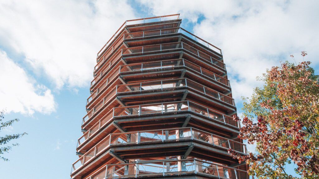
7. Discover the newest hike in the Laurentians, Le Sentier des Cimes
The Sentier des Cimes is the newest ecotouristic attraction in the Laurentians. It’s located near Mont-Tremblant, on the Routes des Belles-Histoires, one of Quebec’s best scenic drives. It’s the perfect stop on your road trip through the Laurentians from Montreal or Ottawa.
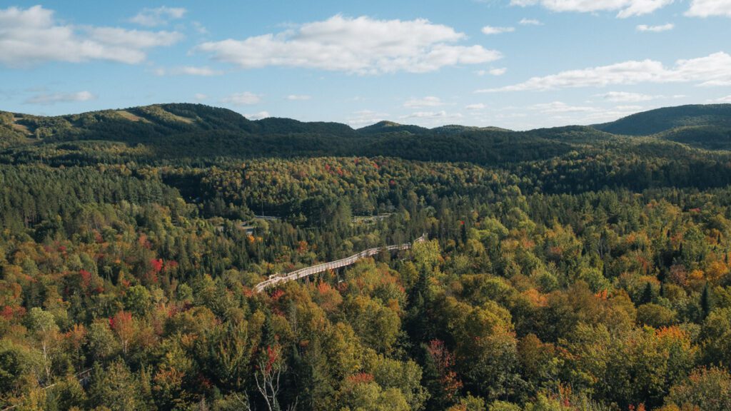
The trail is truly unique, not only in the region but also in Quebec. The highlight is climbing up the spiral to get to the 40m platform at the top. There, you can even walk on a net – a safe and exhilarating experience.
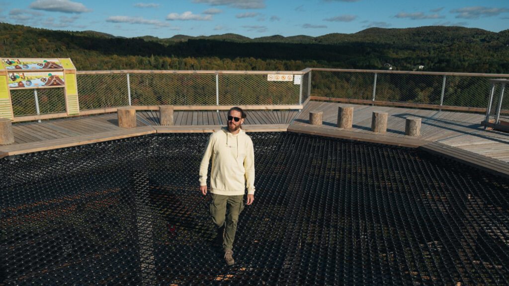
The hike is quite easy all around. You start off going on the elevated platform where you’re at eye level with the treetops. This part is about one kilometer long and there are informational panels and games for kids along the way. Then, when you get to the spiral, you slowly start your ascent. The view at the top of the spiral tower is the equivalent of a 12-story building. It gives you 360 views of the region and its mountains.
Because of the gentle incline and length, the Sentier des Cimes is perfect for families, seniors, and anyone who wants to enjoy the view. It’s also wheelchair and stroller accessible.
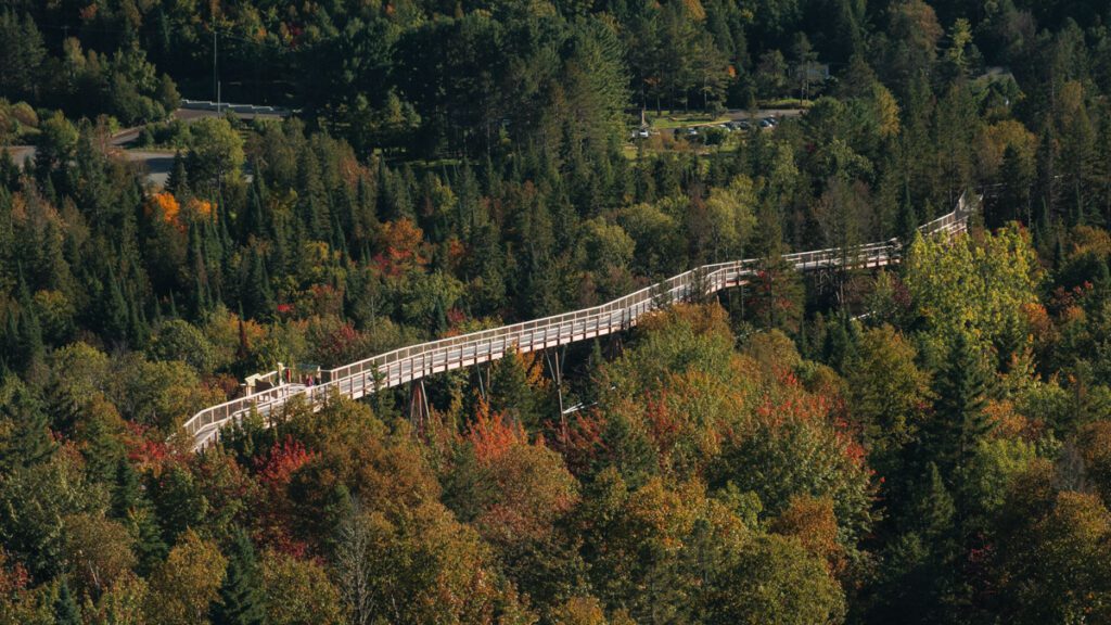
The Sentier des Cimes is located on the P’tit Train du Nord trail, but also on a historic site of an old fish farm. You will notice a few fish icons all around. Plus, a few steps away, you have one of our favorite boutiques – Gourmet Sauvage. This shop is a forager’s dream come true, with tons of products that are locally foraged and harvested. Well worth stopping to discover. Some of our favorite products here are the Wild Milkweed Salsa, the Wild Blueberry jam and the Haskap berry jam as well.
- Difficulty: Easy
- Length of hike: The full loop is about 3-4 km long, and will take about 2 hours to complete. But no need to rush – take your time and read some of the informational panels, enjoy the view at the top, and walk on the net – if you dare!
- How to get there: The Sentier des Cimes is located on the heritage site of the old fish farm of Saint-Faustin, in Mont-Blanc. You can access it on Route 117. It’s also located on the P’tit Train du Nord trail.
- Distance from Montreal: About 1.5 hours there from Montreal, about 125 km.
- Official website: The Sentier des Cimes Laurentides website
- Cost to access the trail: $29 for adults. You can see all the rates here.
- Amenities: You start off at the gift shop where there are bathrooms, souvenirs for sale and more information about the structure. On the site, there is also a restaurant, Chez Emile, where you can enjoy one of the many delicious items on their menu.
8. Walk along the P’tit Train du Nord, a hike that spans across the Laurentians
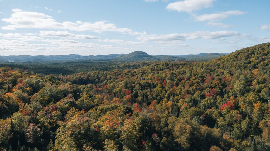
Le P’tit du Nord is a trail that goes through a major part of the Laurentians. It’s one of the most famous and historic attractions there – it’s actually where the first train to the Laurentians was located (hence its name). This 234-kilometer-long path is mainly used for cycling but is also open for people to walk, rollerblade or skate, ski, snowmobile and more.
The path officially starts in downtown Saint-Jérôme, at the place de la gare (train station). You can choose to head all the way to Mont-Laurier, or in the opposite direction, to Bois-Des-Fillion. The path crosses most of the major towns in the Laurentians like Sainte-Adèle, Val David, Sainte-Agate-des-Monts, Mont-Tremblant (both the town and the resort), La Conception, and many others.
Although the route is family-friendly, it is not pet-friendly – only guide and service dogs are welcome on le P’tit train du Nord.
What’s great about the P’tit Train du Nord is that there are also many picnic areas and tables along the way, so you can do certain parts of the trail.
- Difficulty: Easy
- Length of hike: The full trail is about 234 km long
- How to get there: There are many starting points and entrances to the trail
- Distance from Montreal: About 30-45 minutes to get to Saint-Jérôme
- Official website: The P’tit Train du Nord website
- Cost to access the trail: Free to access
Other hikes on our Laurentians’ hiking trails bucketlist
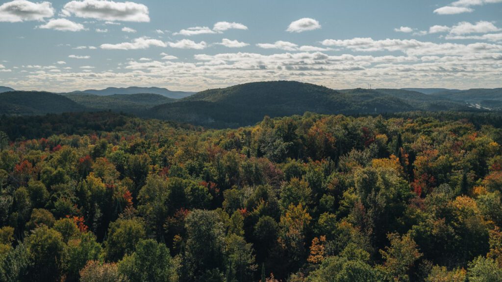
There are a few other trails we want to explore in the Laurentians. Here’s our list of the next hikes we want to check out, let us know in the comments if you’ve done them, and what you think about them.
- Montagne Verte – Located in Lac-Tremblant-Nord, this hike is a short 30-minute ascent to get to a 360-degree panoramic view of the whole region. This hike seems like the perfect low-effort big-gain trail we love – especially when we have so much gear to drag with us!
- Chutes au Rats – Located in the Mont-Tremblant national park, but in the Pimbina-Saint-Donat sector, this waterfall hike has been on our list for a little while, we just need to find the 3 hours to hike it. You can hike the trail or bike it. It’s supposed to be an easy one and it leads you to a 17.4-meter waterfall. And you know how much we love waterfalls on this blog!
- Carcan – This hike is also in Mont-Tremblant national park’s Pimbina-Saint-Donat sector. This trail is one we recently started looking into. It’s a 14km trail that leads to one of the highest peaks in the park (883 m). Plus, there are many waterfalls on the trail, so you know we’ll want to check it out soon!
- Montagne d’Argent – This park is perfect for hikers and climbers who want to go up the rock face of the mountain. The Montagne d’Argent offers 15km of trails located in La Conception. The perfect place to hike if you’re staying in one of the cabins in the Chic Shacks. You can choose to do a shorter 3km hike or the longer 8km one. The best thing about this park is that the trails cross each other, so you can choose the length of your hike and the view you want to get. Plus, it’s a dog-friendly hike!
Camping in Mont-Tremblant national park
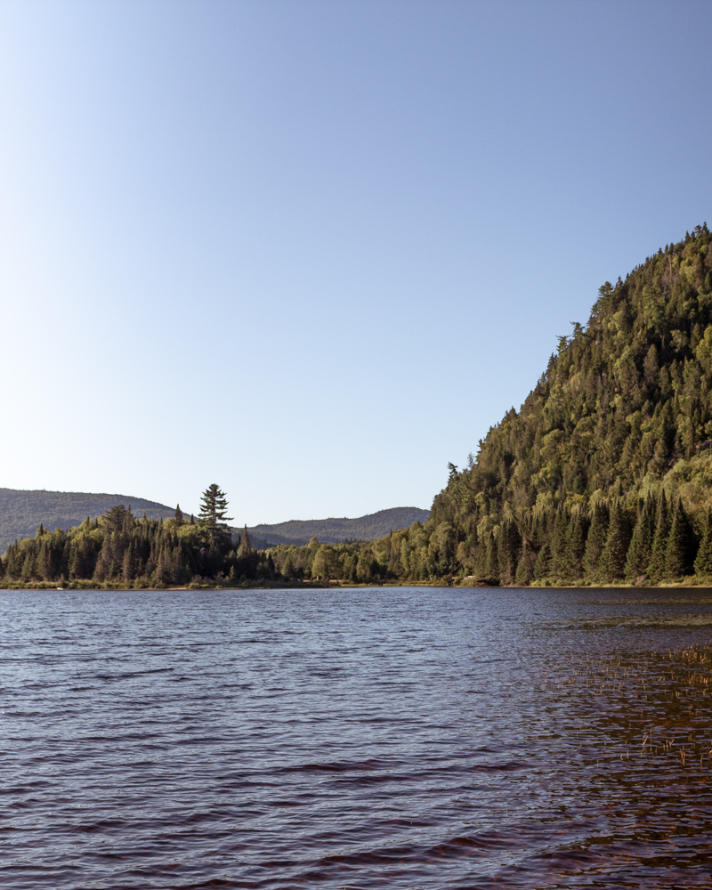
When hiking in the Laurentians, our favorite thing to do is to go camping. Not only does it allow us to have a better connection to nature, but we’re also super close to these amazing hikes. We love to get started early, which means that there aren’t too many people on the trails.
If you’re looking to go camping on in Mont-Tremblant national park, here are the campsites we’ve visited to help you make your choice. They’re all located near the Lac Monroe Discovery Center, in the La Diable sector of the park. Depending on the amenities you’re looking for, here’s what they offer.
- L’Ours campground. We always choose the campgrounds that don’t have services. We usually don’t need electricity for our gear, as we use power banks, and recharge on the road. As far as Sepaq parks and their amenities, this is a good choice. It’s not like the Parks Canada campgrounds, but they have communal areas for bathrooms & showers. There’s running water near the campgrounds, which makes it easier for dishes and drinking water.
- La Sablonnière. This is a great rustic campground – this means that there is no running water on the campground and the bathrooms are outhouses (no running water). So if you like to rough it a little, this is the place for you. There is a nice beach on the site that is perfect on summer nights. If you want to freshen up after all this hiking, you can drive to the nearby campground (Lac-Chat) and use the amenities there. Or you can bring all your own gear and water and rough it up.
A few tips about camping at Mont-Tremblant national park
We love camping at SEPAQ campgrounds – the reason is simple – we’re totally aligned on their mission to help conserve, restore and preserve nature. It’s a win-win for us and the planet. Plus, they are located where the best hiking trail in the Laurentians are!
So here are some tips to help you make the best of camping and hiking in the Laurentians, specifically, at the Mont-Tremblant national park.
- If you want to have the trails mainly for yourself, whether for pictures and video or mostly for enjoying the best of nature, start early in the morning. The later you wait, the more you’ll see crowds. Most people come in for day trips from Montreal, which means they’ll get to the Laurentians around 10-11 am. This gives you ample time to get to the top, without many people around. Pretty fun!
- If you can, avoid weekends, and go on weekdays. There are far fewer people hiking (and camping) on weekdays. This gives you more choices in terms of the trails you want to do and when you actually want to do them.
- The rustic campgrounds don’t have anything, so come prepared. We mentioned it earlier, but the rustic campgrounds at the SEPAQ don’t come with any amenities, except for a few outhouses located on the grounds. However, everything else is up to you to bring – from drinking water to gear and more. There is no running water on the site and nowhere to wash dishes either. So come prepared! If not, you’ll need to drive to another campground in the SEPAQ park to take care of certain things.
The 8 best hikes in the Laurentians
There you have it! These are the 8 best hiking trails to discover in the Laurentians of Quebec. Of course, there are many more, but these are the most notable ones for us.
- La Roche
- La Corniche
- La Coulée
- Chutes-du-diable
- Chutes Croches
- Le Centenaire
- Sentier des Cimes
- P’tit Train du Nord
Let us know in the comments what trails we should explore next. Have you ever done these trails? Which was your favorite one? And which others should we include in our article?
Thank you so much for reading the article all the way through!
We put a lot of time and effort into the content we create. Please like, comment and share – every action on your part helps us out tremendously and is very appreciated.
You can also help us by pinning this article for others to find.


